by Dennis Freeman
After the great presentation by Bernard Chen to SSCC on September 6, Pete Morton and I decided that we would go to Dolly Sods, West Virginia on a scouting expedition – one of Bernard’s favorite photo locations. This was to be a simple one day out-and-back with a few hours of exploring there with our cameras. From this experience we hoped to be able to better plan a successful return trip over a longer stay, perhaps when the leaves change.
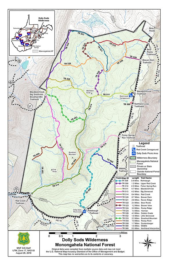
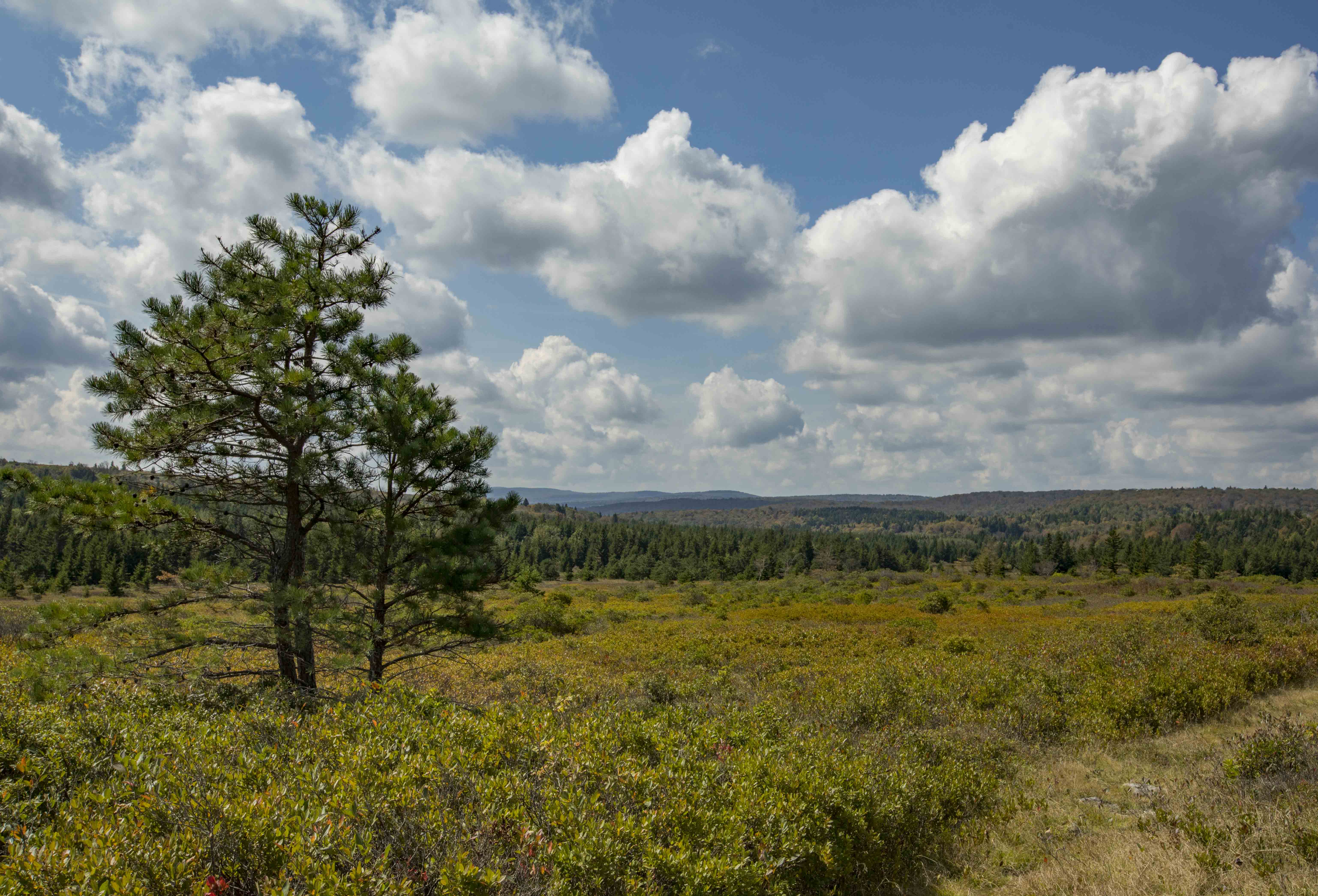
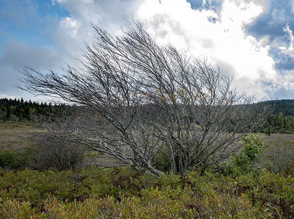
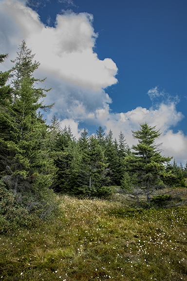
Dolly Sods is a rocky, high-altitude plateau with sweeping vistas and flora more like Canada than anywhere else. To the north, the distinctive landscape is characterized by stunted trees, wind-carved boulders, heath barrens, grassy meadows, and sphagnum bogs. To the south, a dense forest occupies the branched canyon excavated by the North Fork of Red Creek. Dolly Sods Wilderness is a 17,371 acre portion of the larger 32,000 acre “Dolly Sods”. It has 47 miles of trails accessed by only a few roads, so it was clear that this was not likely a routine “field trip”, done with minimal planning. A topo map with roads (black dashed lines) and hiking trails (colored lines) is shown below.
Bernard warned that temperatures up there can be quite a bit colder than the surrounding region, with frequent high winds, necessitating precautions with layered clothing and unseasonable jackets.
Planning
I started planning by doing basic overview research on the internet. Wikipedia has a good page on Dolly Sods Wilderness. That’s where I found the map, above. I then searched on “Dolly Sods photography” and found the Loaded Landscapes site. The author shows by example that Bear Rocks is a primo location within Dolly Sods. We can recognize Bernard Chen’s subject matter in these photos, as well. So, if we only had one place to visit there on our scouting expedition, we should shoot for this.
You can see Bear Rocks on the map, above, in the top right corner. FR (Forest Road) 75 makes a hairpin turn there, with a parking area. The Loaded Landscapes site includes a photo of FR 75 that you should take a look at before going there. There are six miles of travel on that road to get to the parking area, and this is a good representation.
You can find various trail guides for Dolly Sods online, including this 6.5 mile, 700 foot elevation gain, “moderate” semi-circuit hike on Bear Rocks trail from the parking area on FR 75: alltrails.com/bear-rocks-trail-to-raven-ridge-trail-and-dobbin-grade-trail. This is the #1 trail in Dolly Sods! Read the comments to get a sense of trail conditions, hazards, etc. Notice how many reviewers used the word “muddy” or “knee-deep”. Caution: when these reviews use the term “moderate” for a trail, consider that the hikers are almost all young, and in-shape. You’d be lucky to average 2 miles/hour on a rocky muddy trail, never mind stopping for photos. This trail loop therefore requires as much as 4+ hours with breaks for a leisurely pace. That means bringing boots, hiking poles, pack, lunch, water, rain gear, map, etc.
My next research resource is software that I find indispensable for planning trips “into the wild”. It is Google Earth. You can launch it in your browser or download Google Earth Pro to your computer for free. I have it on my computer. It provides a 3D earth that you can navigate interactively. It drapes satellite imagery on top of the underlying topography. You can search for a location of interest, say “Dolly Sods” or “Bear Rocks”, and it will take you there.
You can change your orientation and height above ground to see an area of interest from any angle, and zoom in or out. You can “fly” along the ground as well. You can optionally drop roads, political boundaries, photos, and other items onto the view as well. You can measure distances and elevations, and determine if a trail is too long or too steep for you. Previous users have loaded photos they took, and the metadata in them locates them as an icon you can open on the landscape, and see the photo. Caution: sometimes the metadata location was the last GPS reading they took in the parking lot! You’ll have to figure that out.
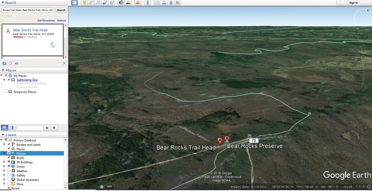
I used Google Earth (searching on “Bear Rocks Trailhead” [Davis, WV]) to get to the location. I determined that the classic Bear Rocks compositions were a short walk of no more than a half-mile from the parking area through what appeared to be a network of small “social” trails on the ridge. And I determined that the parking area at the hairpin turn was at 39 degrees 03 minutes 57.5 seconds North latitude, and 79 degrees 18 minutes 06 seconds West longitude. (I plugged these into my car’s GPS navigation system to plan my route there). Here is the location in Google Maps – Bear Rocks Parking. Here is a view in Google Earth:
So, the plan was to leave at 8:30 a.m., and drive to Bear Rocks parking, spend a few hours, and drive back. I decided to bring my Jeep due to my uncertainty with the conditions on the unpaved Forest Road. We planned to pack lunches and water, and I decided to bring collapsible hiking poles. We planned to pack cameras, tripods, wide angle lenses, panorama clamps and nodal rails into photo backpacks. We planned light weight jackets, hats, sunglasses, and boots. I prepared a list of camera settings and nodal rail settings for doing panoramas with exposure bracketing.
The Trip
It took ~3.5 hours to get there, and in the last hour we didn’t see many stores, restaurants, gas stations, etc. We knew that sunrise would be optimal for photography, but arrived at noon, so the sun wasn’t dramatic and the fog below had already burned off. We did have partial clouds that were very nice.
Getting to the parking area at Bear Rocks required driving six miles on a gravel Forest Service road. It wasn’t hazardous though. But, there were downed trees cut back from the roadway, so you got a sense that you were “out there”. The parking area was pretty full, with maybe 10 vehicles of varying types, i.e. nothing special is required. And this was mid-week before fall colors even start. There are no restrooms or any other accommodations, so you have to be self-sufficient in every way. We saw maybe 10 older people (older than us) on short hikes, and four young people in their 20’s with backpacks on the trail. There was no one in between these extremes.
The area surrounding the parking lot is on top of a ridge with big boulders (Bear Rocks). This is where most of the classic compositions are done with sun or fog on the horizon, and large rocks in the foreground. These boulders are not really “roadside” though. There are a number of social trails throughout this area, providing relatively easy access to them. One of us wore low top walking shoes (due to a timing issue in getting his boots in time), and the other wore waterproof hiking boots. So, I can provide you with an evaluation of each option!
The classic compositions with large boulders in the foreground and vistas behind are found along the ridge in the Google Earth image above. We figured that the walking shoes just might be OK on top of the ridge, where you’d expect things to be drier. The hiking poles would provide added stability to the low shoes when hiking over the trail rocks.
But when we arrived, we observed a couple inches of standing water all along the small trails leading to the big boulders. The grassy spots on the sides of the trails were boggy with a couple of inches of water. Your feet (and tripod) would slowly sink into it if you stood there. And you really want to be able to cross through areas like that to get to good compositions. While the waterproof hiking boots were ideal, the walking shoes were a non-starter in that direction. And this is on the ridge! (Trail reviews indicate that things get lots dicier elsewhere in Dolly Sods)
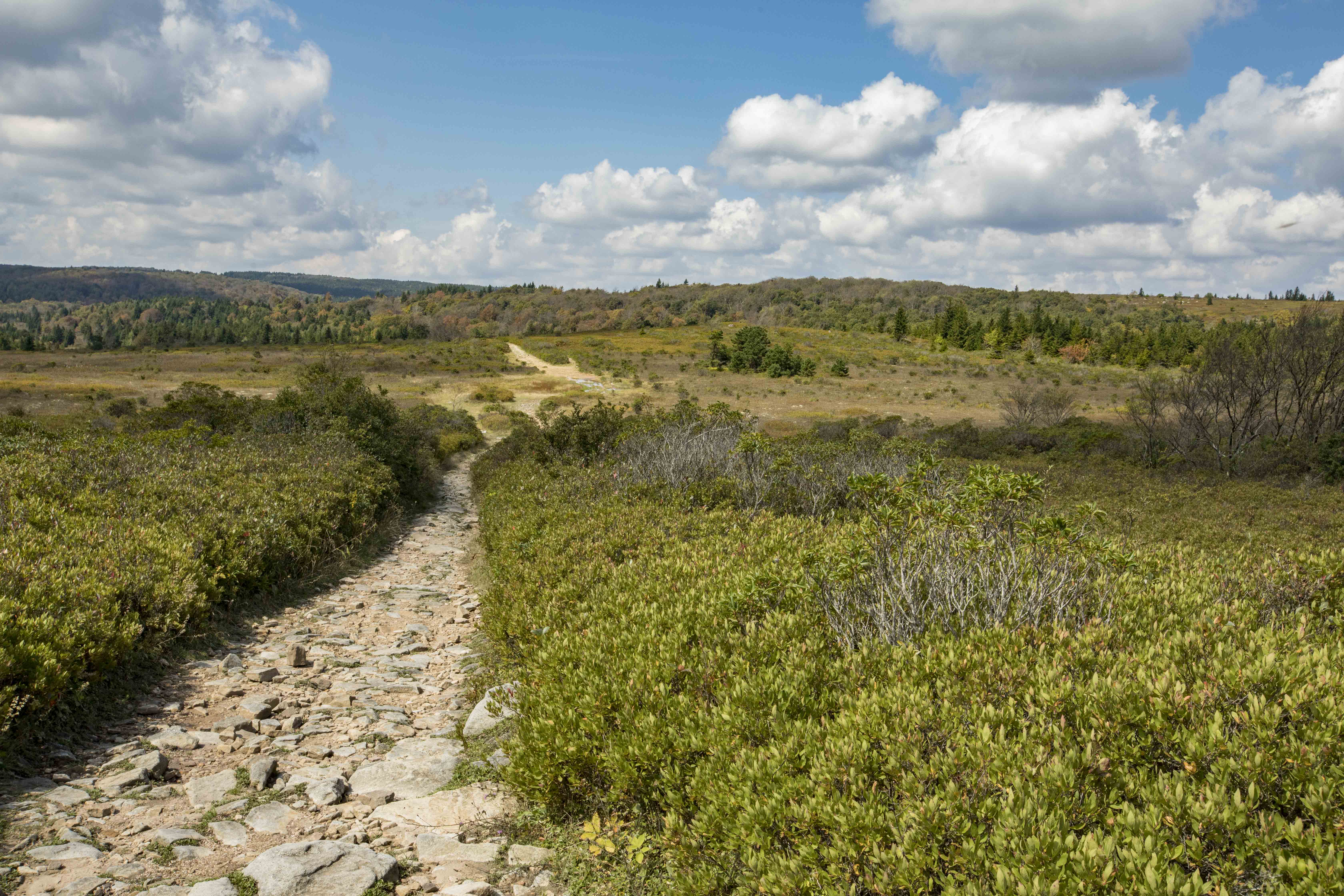
The nearby major named trail (Bear Rocks Trail) was in much better shape than the trails through the rocks, and easily accessed from a couple hundred feet down the road from the parking area, so we took that for maybe a mile and a half before turning back. We still had to navigate around large pools on the trail in a few spots. There were even large springs percolating over (and under) the trail in one area.
That trail had modest elevation changes (we may have descended ~200 feet or more), but we were dilly dallying, so it wasn’t too strenuous. We turned around before a big downhill though – if we had proceeded, we would have had a long uphill hike coming back. One of us discovered that his walking shoes also didn’t provide enough foot-bed support, as hiking on lots of trail rocks with shoes having a soft foot-bed becomes punishing. The one with hiking boots did much better. Cell coverage was iffy. I got AT&T occasionally, but Pete failed to find a Verizon signal.
Long lenses aren’t the most frequent selection there. I switched between my 16-35 mm and my 24-105 mm for all but one shot. Pete used his 24-105 mm almost exclusively, although he did bring out a 70-200 mm f/4 once, and that was an excellent telephoto zoom lens due to its smaller size and weight (relative to an f/2.8 version). When I go next time I’ll add my 100 mm macro to my wide angle zoom and medium range zoom. Not having it was a mistake – there are lots of interesting flowers and plants. Pete brought circular polarizers, but I forgot mine. A circular polarizer will be important for serious landscape photography, i.e. to reduce the sheen on the foliage and enhance the saturation of the colors.
We were keen to do panoramas, but that was really for the notional Bear Rocks compositions that we didn’t get to. The time of day wasn’t great for grand landscapes, so that wasn’t a big loss. Next time, with an early start, the equipment list must include: tripod, ballhead, and pano clamp and nodal slide with level. So, between that and multiple lenses, that’s a fairly heavy pile of gear stuffed into a large photo backpack! If one dispenses with pano gear and tripods, the requirement is very modest.
Also, for panoramas, I had prepared notes to remind myself of all the setting changes I needed. e.g. manual focus with IS (Image Stabilization) turned off on the lens, fixed (not auto) white balance, fixed ISO setting (not auto), Manual mode with fixed shutter speed and aperture selections. I was prepared to do HDR (High Dynamic Range) processing by doing automatic exposure bracketing (varying the shutter speed, not the aperture) at each of ~ 9 pano angles. This was going to result in a need to combine ~3 x 9 = 27 shots for one pano image! I was fairly excited to try it, and still am – for October.
I can help with the somewhat esoteric panorama planning, hike planning (I used to lead group hikes), helpful websites, Google Earth usage, etc. if you are planning to go sometime! You’ll need some lead time if you don’t have broken-in boots.
-Dennis
Additional Resources:
Fall Color Report (lags reality a bit)
Dolly Sods Facebook Site (daily comments and photos)

