By Bruce and Renee Schaefer
First – how do you say it? Most people rhyme The Palouse with booze. But at least one native of Washington rhymes it with carouse. True, he was a California transplant who’d never heard a Palousian pronounce it. But I think he was onto something.
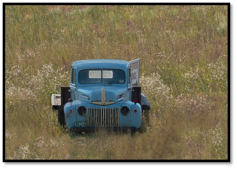
Second – what is The Palouse? It is a large area of mostly farmland an hour south of Spokane in eastern WA, very near the border with Idaho. The land rolls and undulates in fairly shallow hills and gullies; at sunrise or sunset, it comes into sensual relief, making for great postcard pictures. On top of that, the area is sprinkled with red barns, tumble-down collapsing old farmhouses, and abandoned trucks from the 1940s: the region simply oozes Americana. This link will give you an idea what to look for and how to shoot them.
My Top 25 Spots in the Palouse (as of June 2020) – Murali Narayanan Photography (muralipix.com)
We dared the pandemic to fly out to WA in August 2021. The proximate cause was a wedding in Seattle; we extended the trip to spend 2 days exploring The Palouse and another 2 cruising Coeur d’Alene and nearby Wallace ID. [Wallace is often named one of the cutest small towns in the US. It was.]
He Plans to Fail Who Fails to Plan
Preparation included spending, oh, about $1000 on a telephoto lens we thot would better capture the land, what with all those expanses. We also downloaded maps of the state of WA to use for, we don’t know what. As it turned out, they were a lifesaver, as we ran out of cell signals several times for long periods.
And we booked an Airbnb that, come to find, lay at the foot of the one major mountain in the area, 3600-foot Steptoe Butte, from which you get spectacular views to actually use that new lens. We drove to the top for sunrise and sunset.
What we didn’t plan for was cold weather in August. So we had some bracing moments in the winds atop that Steptoe hill and on the 2 ferry rides we took earlier in Seattle. Pack accordingly.
Our best piece of preparation was to bring the link above; we used it as a checklist, finding or stumbling upon 8 or 10 of the 25 sights listed there.
Our Modus
We spent the first morning and evening catching the low sunlight from Steptoe. After breakfast, we sought out a few of the nearby places on the list of 25 above: the American barn, the abandoned granary, the Eid Road barns, and the Dahmen barn with wheels. The downloaded GPS maps helped here, as T-Mobile had many a gap in cell coverage.
Driving randomly between these spots, we stumbled upon all sorts of old trucks, collapsed buildings, contrasty fields of gold and green, hay bales, small towns featuring Richfield gas stations and flag-themed murals. Serendipitous images are guaranteed.
We also met some Palousians. The country roads were mostly empty, but we encountered people in the restos and stores we visited. There were a few characters, but don’t expect a lot of street photography here. The Palouse is really about landscapes.
Here are some of what we found. We’ll be happy to advise anyone who is thinking of a trip there.

